


Hong Kong Solutions for Sustainable Urban Development Used to Develop “Breathing Cities” on the Mainland
The “Hong Kong Urban Climatic Map” (UCMap) is the output of a study commissioned by the Hong Kong SAR Government. It is the first holistic spatial evaluation of Hong Kong’s urban climate. Its purpose is to evaluate urban climatic conditions, detect climatic problem areas and develop appropriate design strategies for sustainable urban development and environmental design.
Since 2007, the Government’s Planning Department has gradually adopted the findings of the project in the review exercises for its outline zoning plans.
 Professor Chao Ren is an Associate Professor in the School of Architecture at CUHK.
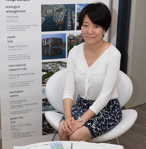
A new related project focuses on Mainland urban development problems and needs. In the past few years, because of the successful implementation of Hong Kong’s UCMap project, Professor Chao Ren, Associate Professor of CUHK’s School of Architecture and one of the project leaders, has received a number of governmental consultancy invitations from various municipalities on the Mainland. A new concept of a “breathing city” was developed, based on the Hong Kong UCMap project, and has been introduced to Mainland cities for urban development planning and climate change adaption.
The challenges brought about by the high urbanization rate in China in the past 30 years are unparalleled in the history of the world because of the sheer numbers involved. The urbanization rate is expected to reach 60% in the years 2020–2025, compared to about 56% today and only 16% in 1960.
Along with the largest migration in human history, the country has experienced the fastest economic growth and pace of industrialization in history, which has created major environmental problems, including urban heat islands, poor urban ventilation and severe air pollution, resulting in increased air-conditioning use and escalating public health problems.
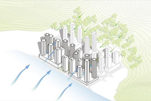
To deal with these challenges, strategies are needed to improve urban ventilation and mitigate the urban heat island effect. The solution is to develop a “breathing city” to ensure free air flow in both the perimeter and central zones of cities. This requires appropriate environmental design and climate-responsive planning at the regional, urban and district levels, including spatial analysis of the urban climate conditions and environmental resources of each city, followed by an adaptive plan for developing a healthy city and combating climate change. The recommended holistic environmental design measures include increasing the amount of greenery in all parts of the city, placing buildings of various heights next to each other, designing buildings at an oblique angle to the prevailing wind direction to provide natural ventilation to both buildings and streets, and making city and buildings more permeable.
The “breathing city” concept and suggested implementation strategies are tailor-made for Mainland urban planning systems, providing solutions for urban planners and governments.
The current central government plan requires over 300 cities on the Mainland to finish their wind corridor plans by the end of 2017. This is considered to be one of the most effective measures for climate change adaptation and eco-planning at the city level.
by Paul Paskewitz